|
Le rôle des cartographes et des validateurs
Les cartographes, organisés par départements, ont pour principales missions de constituer et d’animer leurs réseaux d’observateurs et de construire des bases de données locales (départementales) regroupant toutes les données d’observation (Orchisauvage et autres … par exemple les données de l’ancien Atlas SFO 2010 et aussi les données que la FFO reçoit par le biais de conventions d’échanges avec divers organismes).
Ces missions s’inscrivent dans les objectifs statutaires de la FFO qui sont en matière d’orchidées indigènes d’accroître les connaissances (ex. biologie, répartition…) et de participer à leur préservation et à la conservation de leurs biotopes.
Les données doivent être vérifiées et validées de façon à ce que les exploitations qui en sont faites (par exemple les publications livresques ou Internet) soient fiables et représentatives. C’est pourquoi dans une très grande majorité les cartographes sont également les validateurs référents de leur département et constituent au sein de la FFO une seule et même communauté de « Cartographes-Validateurs ».
A ce titre les cartographes-validateurs sont les contacts privilégiés des contributeurs d’Orchisauvage et sont à leur disposition pour les aider dans leurs prospections, dans la détermination des plantes qu’ils observent ou pour tout autre sujet.
Le détail de leurs missions est décrit sur le site Internet de la FFO à la rubrique « Cartographie »
=>https://france-orchidees.org/
Pour les aider dans l’exercice de leurs missions, la FFO a mis en place un processus d’accréditation concrétisé par la signature d’une convention entre la FFO et chaque cartographe-validateur officialisant leur rôle et décrivant leurs droits et leurs devoirs.
C’est ainsi que chaque cartographe a accès à toutes les données naturalistes de son département (ou de sa région pour les cartographes régionaux) saisies sur le site Orchisauvage ou via l’application Naturalist. Ces accès (ouverture des droits d’export et de validation) sont gérés par le groupe d’administrateurs du site Orchisauvage selon les directives de la FFO. La liste des cartographes-validateurs associés aux départements pour lesquels ils sont accrédités est consultable sur ce site.
=> https://www.orchisauvage.fr/index.php?m_id=20053
Par l’accréditation, la FFO confère au cartographe-validateur le droit d’utiliser toutes les données naturalistes de son département ou de sa région, dans le cadre des missions statutaires de la FFO (connaissance, préservation/protection). Il peut les utiliser en particulier pour des publications. Dans le cas de publication de données individualisées, l’observateur sera cité s’il n’a pas choisi l’anonymat.
Le cartographe-validateur est engagé à respecter la réglementation concernant l’utilisation et le stockage des données personnelles (RGPD) qu’il est appelé à consulter ou à manipuler et comme tout inscrit sur le site, il est engagé à en respecter les Conditions Générales d’Utilisation (CGU). Il ne peut utiliser à des fins commerciales les données naturalistes mises à sa disposition par la FFO sur le site Orchisauvage.
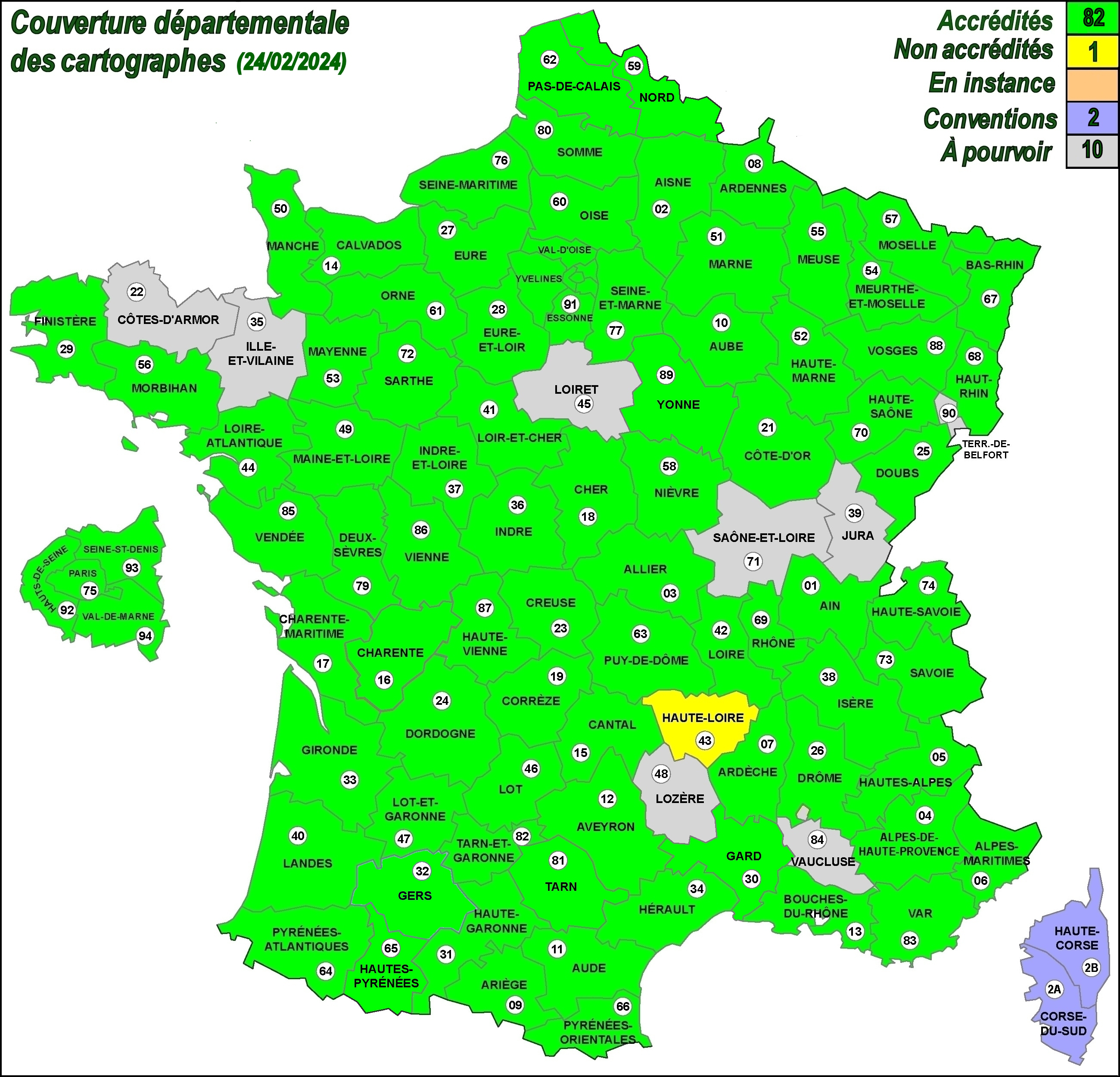
Comme le montre la carte ci-dessous, une vingtaine de départements sont encore démunis de cartographe et les candidatures des contributeurs d'Orchisauvage auprès de la Commission cartographie sont les bienvenues.
=> cartographie@france-orchidees.org

Mise à jour : 18/02/2024
|


